GEOVAI

GEOVAIGEOVAIGEOVAI

GEOVAI

GEOVAIGEOVAIGEOVAI
  • Sign In
  • Create Account

  • My Account
  • Signed in as:

  • filler@godaddy.com


  • My Account
  • Sign out

Signed in as:

filler@godaddy.com

  • GEOVAI
  • Mining - all at once
  • Multiphysics Everywhere
  • Geotechnical Engineering
  • Hydrology & Hydrogeology
  • Specialized Drilling
  • Technologies & Net Zero
  • Our Permit to Work
  • CONTACT US
  • Investors & Company

Account


  • My Account
  • Sign out


  • Sign In
  • My Account

Geophysical Services Everywhere
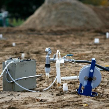
Land Operations

Land Operations

Land Operations

our field operations include wide range of Multiphysics measurements and data acquisition, including magnetics, electromagnetics, gravity, resistivity and  Ground Penetrating Radar.

Airborne

Land Operations

Land Operations

We collaborate with the best in class partners to offer our customers in Saudi a full suite of services from above. those services and measurement will operate on fixed wing, Drones, and Heliportable crafts. some of the technologies we run are property of our partners and are subject to US trade controls.

Offshore

Land Operations

Offshore

While we focus on Land and Air operations, we find ourselves obliged to expand into water. our Marine services are limited to magnetics and Bathymetric Surveying at this stage. However, we have partnered with leading European organizations to bring more services to Saudi. 

Precise Geophysical Measurements

Ground Magnetic Surveys

It measures the terrestrial magnetic field to identify and detect local variations due to magnetism and ferro-magnetism of local geological structures. 

Electromagnetic Surveys on Land

TDEM and VLF methods allows to determine subsurface electrical properties of the rocks and has application in mineral, ground water exploration and environmental mapping. 

Gravity on Ground

Records small variations in Earth's gravity field while operating in a moving aircraft or through scanning on the ground.  

Resistivity

GEOVAI provides full range of Ground Electrical surveys e.g., IP/SP Resistivity etc. 

Ground Penetrating Radar

Uses high frequency electromagnetic pulse to acquire high resolution subsurface data and information.  

Magnetotellurics

An electromagnetic geophysical method that is used to measure earths subsurface electrical conductivity from measurements of natural geomagnetic and geoelectrical field variations at the earth surface.  

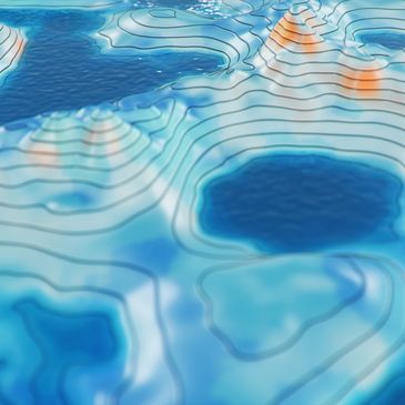
Multiphysics, Multipurpose

Remote Sensing & Hyperspectral Imaging

GEOVAI provides Hyperspectral imaging services that are used to analyze the electromagnetic spectrum to identify each pixel spectrum that serves as a purpose of identifying materials. Hyperspectral imaging is used as first instance for exploration of different types of minerals and rocks.

Filed Measurements

We operate and run well-designed programs. We do not just provide studies and great ideas. we put plans in action and we execute field operations to acquire excellent and precise data for our customers. 


we operate in remote and challenging environments while maintaining the highest possible level of safety. we take responsibility of our subcontractors and we develop local content.

Processing & Interpretation

our experts with extensive experience will provide a full solution to our customers. at GEOVAI, we do not just provide precise dataset, but we will also include fully processing and interpretation of acquired data to help our customers to save time, and make an informed decision. 

Airborne Geophysics

Gamma Ray Spectrometry

GEOVAI provides services for Gamma Ray Spectrometry that is used for geological mapping of rocks with radioactive concentrations and alterations.

LiDAR

GEOVAI provides LiDar services that is the measurement of 3D ground surface is essential for accurate calibration of terrain for various airborne surveys.

Magnetic Surveys

It measures the terrestrial magnetic field to identify and detect local variations due to magnetism and ferro-magnetism of local geological structures. 

Electromagnetic

TDEM Surveys and VLF methods allows to determine subsurface electrical properties of the rocks and has application in mineral, ground water exploration and environmental mapping. 

Gravity & Gravity Gradiometric

GEOVAI provides services for airborne gravity and gravity gradiometric surveys that are used to measure the spatial rate of change of the components of the gravity field. 

Data Library

Data Collections

When applicable by law and regulations, and as mutually agreed with our partners, we collect our acquired Geological and Geophysical datasets into our Geological database to offer our clients the opportunity to obtain data on effective and economic values. 

Our Strategy

GEOVAI acquire multi-client datasets to help investors to review potential and make an informed decision. Datasets are available in different formats and packages subject to value and risk.

Value of Information

Value of Information is defined as the marginal benefit gained from a decision made with extra knowledge compared to one made without it. Information has no intrinsic value; its worth is entirely instrumental, realized only when it reduces uncertainty or leads to a measurably better outcome.

Subscribe

Stay upto date about our coming services

  • GEOVAI
  • Mining - all at once
  • Multiphysics Everywhere
  • Geotechnical Engineering
  • Hydrology & Hydrogeology
  • Specialized Drilling
  • Technologies & Net Zero
  • Our Permit to Work
  • Terms & Conditions
  • Privacy Policy
  • CONTACT US
  • Investors & Company

Geovai

Copyright © 2026 Geovai - All Rights Reserved.

This website uses cookies.

We use cookies to analyze website traffic and optimize your website experience. By accepting our use of cookies, your data will be aggregated with all other user data.

Accept